Office email
Office Phone
Personal email
Personal phone
Building No. 1
C
Floor No. 1
4
Room No. 1
408
Since June 2012 I have been working at the IRSM CAS, starting as a postdoc at the Dpt. of Engineering Geology, afterwards (from 2015) as a researcher at a newly established Dept. of Neotectonics and Termochronology where I act also as the deputy head.
Since 2011 I have also been working (part-time) as a researcher (2011 - 2017) and later (since 2018) as an assistant professor (lecturer) at the Institute of Hydrogeology, Engineering Geology and Applied Geophysics at the Faculty of Science, Charles University, Prague where I completed Ph.D. in Applied Geology with the focus on geophysical applications by defending the Ph.D. dissertation on "Joint interpretations of geophysical measurements as the key to understand landscape evolution" in March 2022.
As concerns my professional scope, I am interested namely in geomorphology, structure geology, dynamic processes and applied geology (near surface geophysics and engineering geology). Within my research activities, I do co-operate with numerous Czech geoscience institutions (Charles University, Czech Geological Survey, Geophysical Institute CAS, University of Ostrava or the University of West Bohemia in Pilsen) as well as with foreign partners (University of Wroclaw, Polish Academy of Sciences, San Diego State University or Oregon State University).
Besides the domestic research, my activities include also co-operation within the international research projects, e.g. in Slovakia, Poland, Germany, Norway (Svalbard), Ukraine (Krym - I have never been to Russia!!!), Iraq (Kurdistan), India (Kashmir), Philippines, California…
My publication activity is represented by numerous scientific papers and research reports, analyses and expert’s opinions. My ORCID is 0000-0002-5159-7703.
I have also rich experience with a range of projects oriented on applied research in collaboration with private companies (Geotest a.s., G Impuls Praha, Energoprůzkum Praha, Dekonta, CEZ Group etc.) and, also, with state authorities (e.g. SÚRAO – Czech Radioactive Waste Repository Authority, ŘSD - Czech Road and Motorway Directorate, Czech Ministry of Transport, Criminal Police and Investigation Service, Nature Conservation Agency etc.).
At the Charles University, Faculty of Science (Prague), I participate in lecturing and leading of practicals (e.g. Geoelectrics – practicals, Geoelectrical survey, Field Course of Applied Geophysics, Seminar of Applied Geophysics, etc.) at the Inst. of Hydrogeology, Engineering Geology and Applied Geophysics and at the Dpt. of Physical Geography and Geoecology (Geomorphological Research Methods). I am also supervising theses at both departments. Furthermore, I was also lectured students (in Applied Geophysics) at my alma mater, University of Ostrava, in years 2012 – 2019.
I am a member of following professional associations: EAGE (European Association of Geoscientists and Engineers), ČAG (Czech Association of Geomorphologist, since 2020 as a vice-chairman), ČAAG (Czech Associations of Geophysicists) and IAEG (International Association for Engineering Geology and the Environment).
Břežný M., Pánek T., Braucher R., Šilhán K., Chalupa V., Lenart J., Tábořík P., Aster Team (2021): Old but still active: >18 ka history of rock slope failures affecting a flysch anticline. Landslides 18, 89–104. DOI 10.1007/s10346-020-01483-7.
Share P.-E., Tábořík P., Štěpančíková P., Stemberk J. jr., Rockwell T.K., Wade A., Arrowsmith J.R., Donnellan A., Vernon F.L., Ben-Zion Y. (2020): Characterizing the uppermost 100 m structure of the San Jacinto fault zone southeast of Anza, California, through joint analysis of geological, topographic, seismic and resistivity data. Geophysical Journal International 222(2), 781-794. doi: 10.1093/gji/ggaa204.
Hartvich F., Tábořík P., Šobr M., Janský B., Kliment Z., Langhammer J. (2020): Landslide-dammed lake sediment volume calculation using waterborne ERT and SONAR. Earth Surface Processes and Landforms 45(14), pp. 3463-3474. DOI: 10.1002/esp.4977
Klanica R., Kadlec J., Tábořík P., Mrlina J., Valenta J., Kováčiková S., Hill G.J. (2020): Hypogenic versus epigenic origin of deep underwater caves illustrated on the Hranice Abyss (Czech Republic) - the world’s deepest freshwater cave. Journal of Geophysical Research: Earth Surface 125(9), e2020JF005663. https://doi.org/10.1029/2020JF005663
Uxa T., Křížek M., Krause D., Hartvich F., Tábořík P., Kasprzak M. (2019): Comment on 'Geophysical approach to the study of a periglacial blockfield in a mountain area (Ztracené kameny, Eastern Sudetes, Czech Republic)' by Stan et al. (2017). Geomorphology, 328, 231–237. https://doi.org/10.1016/j.geomorph.2018.10.010. (IF = 3.308).
Hošek J., Valenta J., Rapprich V., Hroch T., Turjaková V., Tábořík P., Pokorný P. (2019): Newly identified Pleistocene maars in Western Bohemia (Czech Republic). Geoscience Research Reports 52(2), 97-104. DOI: 10.3140/zpravy.geol.2019.23 (Scopus)
Blecha V., Fischer T., Tábořík P., Vilhem J., Klanica R., Valenta J., Štěpančíková P. (2018): Geophysical evidence of the eastern marginal fault of the Cheb basin (Czech republic). Stud. Geophys. Geod., 62/4, 660–680. DOI: 10.1007/s11200-017-0452-9. (IF = 0.987)
Chalupa V. , Pánek T., Tábořík P., Klimeš J., Hartvich F., Grygar R. (2018): Deep-seated gravitational slope deformations controlled by the structure of flysch nappe outliers: Insights from large-scale electrical resistivity tomography survey and LiDAR mapping. Geomorphology, 321, 174–187. (IF = 3.308)
Břežný M., Pánek T., Lenart J., Grygar R., Tábořík P., McColl S.T. (2018): Sackung and enigmatic mass movement folds on a structurally-controlled mountain ridge. Geomorphology, 322, 175-187. (IF = 3.308)
Petronis M., Valenta J., Rapprich V., Lindline J., Heizler M., Van Wyk de Vries B., Shields S., Balek J., Fojtíková L., Tábořík P. (2018): Emplacement History of the Miocene Zebín Tuff Cone (Czech Republic) revealed from Ground Geophysics, Anisotropy of Magnetic Susceptibility, Paleomagnetic, and 40Ar/39Ar Geochronology Data. Geochemistry, Geophysics, Geosystems, 19/10, 3764-3792. DOI: 10.1029/2017GC007324 (IF = 2.98)
Lenart J., Kašing M., Tábořík P., Piotrowska N., Pawlyta J. (2018): The Cyrilka Cave—the longest crevice-type cave in Czechia: structural controls, genesis, and age. International Journal of Speleology 47 (3), 379-392. https://doi.org/10.5038/1827-806X.47.3.2210. (IF = 1.439).
Tábořík P., Lenart J., Blecha V., Vilhelm J., Turský O. (2017): Geophysical anatomy of counter-slope scarps in sedimentary flysch rocks (Outer Western Carpathians). Geomorphology 276, 59-70. DOI:10.1016/j.geomorph.2016.09.038. (Elsevier, IF = 2.958)
Špaček P., Valenta J., Tábořík P., Ambrož V., Urban M., Štěpančíková P. (2017): Fault slip versus slope deformations: Experience from paleoseismic trenches in the region with low slip-rate faults and strong Pleistocene periglacial mass wasting (Bohemian Massif). Quaternary International 451, 56-73. http://dx.doi.org/10.1016/j.quaint.2017.05.006. (Elsevier, IF = 2.199)
Klimeš J., Hartvich F., Tábořík P., Blahut J., Briestenský M., Stemberk J., Emmer A., Vargas R., Balek J. (2017): Studies on selected landslides and their societal impacts: activity report of the Prague World Centre of Excellence, Czech Republic. Landslides 14(4), 1547-1553. DOI 10.1007/s10346-017-0837-4. (Springer, IF = 3.657)
Tábořík P., Gebauer J., Duras R., Bláha P. (2017): The Mystique of ERT. EGRSE – Exploration Geophysics, Remote Sensing and Environment 2017/2: 28 - 37. ISSN 1805-2266.
Tábořík P. (2016): Voda v semiaridních oblastech iráckého Kurdistánu. Geografické rozhledy 25/5, 8-9. ISSN 1210-3004
Urban J., Pánek T., Hradecký J., Tábořík P. (2015): Deep structures of slopes connected with sandstone crags in the upland area of the Świętokrzyskie (Holy Cross) Mountains, Central Poland. Geomorphology 246, 519-530. (IF = 2.79)
Stacke V., Tábořík P. (2015): Interaction of the hillslopes and valley bottoms on the NW slope of the Lysá hora Mt., the highest peak of the Western Beskids. Carpathian Journal of Earth and Environmental Sciences 10(2):159 – 174. (IF = 0.727)
Šálek O., Matolín M., Tábořík P., Štěpančíková P. (2015): Detailní gamaspektrometrické stanovení přírodních radionuklidů K, U a Th na okrajovém sudetském zlomu. Geoscience Research Reports for 2014 (vol. 48), 48, 99–102. DOI 10.3140/ZGV.2014.02. (Scopus)
Pánek T., Hartvich F., Jankovská V., Klimeš J., Tábořík P., Bubík M., Smolková V., Hradecký J. (2014): Large Late Pleistocene landslides from the marginal slope of the Flysch Carpathians. Landslides 11(6): 981-992. (IF = 2.09)
Prokešová R., Kardoš M., Tábořík P., Medveďová A., Stacke V., Chudý F. (2014): Kinematic behaviour of a large earthflow defined by surface displacement monitoring, DEM differencing, and ERT imaging. Geomorphology 224: 86-101. (IF = 2.58)
Prokešová R., Medveďová A., Tábořík P., Snopková Z. (2013): Towards hydrological triggering mechanisms of large deep-seated landslides. Landslides, 10 (3), 239-254.
Fischer T., Štěpančíková P., Karousová M., Tábořík P., Flechsig C., Gaballah M. (2012): Imaging the Mariánské Lázně Fault (Czech Republic) by 3-D ground-penetrating radar and electric resistivity tomography. Stud. Geophys. Geod., 56, 1019-1036. (IF = 0.806)
Pánek T., Tábořík P., Klimeš J., Komárková V., Hradecký J., Šťastný M. (2011): Deep-seated gravitational slope deformations in the highest parts of the Czech Flysch Carpathians: Evolutionary model based on kinematic analysis, electrical imaging and trenching. Geomorphology, 129, 92-112.
Pánek T., Šilhán K., Tábořík P., Hradecký J., Smolková V., Lenart J., Brázdil R., Kašičková L., Pazdur A. (2011): Catastrophic slope failure and its origins: Case of the May 2010 Girová Mountain long-runout rockslide (Czech Republic). Geomorphology, 130, 352-364.
Škarpich V., Hradecký J., Tábořík P. (2011): Structure and genesis of the Quaternary filling of the Slavíč River valley (Moravskoslezské Beskydy Mts., Czech Republic). Moravian Geographical Reports 19 (2), 30-38. ISSN 1210-8812.
Škarpich V., Tábořík P., Hradecký J., (2011): Geomorfologická interpretace údolních den Moravsko-slezských Beskyd na základě geoelektrických měření. Geoscience Research Reports for 2010, vol. 44, 87-92. ISBN 978-80-7075-769-7. (in Czech)
Mentlík P., Minár J., Břízová E., Lisá L., Tábořík P., Stacke V. (2010): Glaciation in the surroundings of Prášilské Lake (Bohemian Forest, Czech Republic). Geomorphology, 117, 181-194.
Pánek T., Margielewski W., Tábořík P., Urban J., Hradecký J., Szura C. (2010): Gravitationally-induced caves and other discontinuities detected by 2D electrical resistivity tomography: Case studies from the Polish Flysch Carpathians. Geomorphology, 123, 165-180.
Bláha P., Černý V., Duras R., Fousek J., Horský O., Lazecký M., Oprchal J., Tábořík P., Peshawa A., Aziz B. Q. (2010): Geoelectrical surveys for the feasibility study of the Bawanur dam site. EGRSE, Exploration Geophysics, Remote Sensing and Environment. Praha: ČAAG. Vol. XVII.2. s. 14-47. ISSN 1803-1447.
Pánek T., Tábořík P., Hradecký J. (2007): Gravitační rozpad hřbetu Čertova Mlýna (Moravskoslezké Beskydy). Geologické výzkumy na Moravě a ve Slezsku v roce 2006, 14, 124-129. ISBN 978-80-210-4400-5. (in Czech)
Faculty of Science, Charles University, Prague
Inst. of Hydrogeology, Engineering Geology and Applied Geophysics
2012 – to date: participation in lecturing and leading of practicals (Geoelectrics – practicals, Geoelectrical survey - practicals, Interpretations of geoelectrical measurements, Geophysical Field Course, Applied geophysics for Erasmus)
Selected lectures within the Seminar of Applied Geology (2010, 2014, 2015, 2019)
Supervising Diploma thesis in the study program Applied Geology with specializations in Engineering Geology and Applied Geophysics.
Dept. of Physical Geography and Geoecology
2012 – to date: participation in lecturing within Geomorphological Research Methods (lecture + practicals)
Faculty of Science, University of Ostrava, Dept. of Physical Geography and Geoecology
2012 – 2019: lecturing of the Applied Geophysics course for the study field Physical Geography and Geoecology (12 lecture blocks + field practicals).
2014 – lecture within the course Selected Chapters of Physical Geography: (2010 – “Geophysical methods in Physical Geography”, 2014 – “Physical Geography as seen by Applied Geophysics”)
Faculty of Education, University of West bohemia, Centre of Biology, Geoscience and Environmental Education
- a member of the committee for state examination – in following fields: Geography with a focus on education, Teaching of geography for primary and secondary schools
University of Wrocław, Institute of Geography and Regional Development
- invited lecture: Tábořík P., Hartvich F. (2018): Application of field geophysics in the research of landscape evolution (22. 2. 2018)
- reviewing Bachelor and Diploma theses for numerous Universities
I am a member of the following professional associations:
ČAG Czech Association of Geomorphologist (since 2020 as a vice-chairman)
ČAAG Česká asociace geofyziků
IAEG International Association for Engineering Geology and the Environment
EAGE European Association of Geoscientists and Engineers (Local Chapter, Prague)
I am a member of the editorial board of EGRSE – International Journal of Exploration Geophysics, Remote Sensing and Environment (ISSN 1805-2266), a peer reviewed scientific journal. Published by CAAG – Czech Association of Geophysicists.
I am a founding member of the EAGE Local Chapter Czech Republic (European Association of Geoscientists and Engineers). LC EAGE is a voluntary, non-profit, professional organisation associating experts from various geoscience fields...
Scientometry:
RCID iD: 0000-0002-5159-7703
Researcher ID: H-4859-2014
Scopus Author ID: 35369432400
Peer reviews for scientific journals (EGRSE; GeoScience Engineering; Pure and Applied Geophysics; Geomorphology; Landslides; Geological Quarterly; International Journal of Geophysics; Technical Transactions; Environmental Earth Sciences; International Journal of Remote Sensing; Geology, Geophysics and Environment; Geoscience Research Reports; Journal of Applied Geophysics etc.)
Professional skills
Field Geophysical Methods: DC resistivity tomography (ERT), Electromagnetic induction measurements (EMI, DEMP), georadar (GPR), shallow seismic refraction, Gravity survey (partly)
Other education and courses
2016 - Society of Exploration Geophysicists – Student Educational Program (SEP) course: Multi-Disciplinary Subsurface Integration in Exploration and Production From “Plates to Pores...”, 8.-10.7.2016, Katowice, Poland
2009 – 2011 - VŠB–Technical University of Ostrava, Faculty of Mining and Geology, Institute of Geological Engineering
- Geological Engineering study program (Master's)
- passed courses: structural geology, geophysical methods, hydrogeology, engineering geology, monitoring, drilling works, rock mechanics, etc.
2008 (March – April) - City College Coventry, Coventry, West Midlands, United Kingdom
IELTS – International English Language Testing System, Preparation Course
- overal score: IELTS – Band 6.5 = C1 level (CEF)
2005 (January – June) - Jönköping University, School of Education and Communication, Jönköping, Sweden
- Media and Communication (Visual Communication, Intercultural Communication, Swedish Language I, II), Global Environment and Survival Issues
- Erasmus/Socrates scholarship
--- Selected field campaigns and expeditions abroad ---
2009 Crimea (Ukraine) - Crimean Mountains: landslides research, limestone landscapes, speleo-survey
2010 Crimea (Ukraine) - Crimean Mountains: landslides research, limestone landscapes, speleo-survey
2010 Kurdistan (Iraq) - Zagros Fold Thrust Belt: geophysical & engineering geological survey for Bawanur water dam
2010 Luzon (Philippines) - Angat water reservoir: landslides research
2010 Slovakia - High Tatra Mts: glacial landforms & alpine landscapes
2011 Slovakia - High Tatra Mts: glacial landforms & alpine landscapes
2013 Slovakia - High Tatra Mts: glacial landforms & alpine landscapes
2014 Slovakia - High Tatra Mts: glacial landforms & alpine landscapes
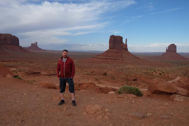
2017 California (USA) - San Jacincto Mts. & Sonora desert: active tectonic research
2017 Svalbard (Norway) - Hornsund fjord area: active permafrost & arctic research
2018 Svalbard (Norway) - Hornsund fjord area: active permafrost & arctic research
2019 California (USA) - San Jacincto Mts. & Sonora desert: active tectonic research
2019 Kashmir (India) - Kashmir Valley, Lower Himalayas: active tectonic research
RCID iD: 0000-0002-5159-7703
Researcher ID: H-4859-2014
Scopus Author ID: 35369432400
Peer reviews for scientific journals (EGRSE; GeoScience Engineering; Pure and Applied Geophysics; Geomorphology; Landslides; Geological Quarterly; International Journal of Geophysics; Technical Transactions; Environmental Earth Sciences; International Journal of Remote Sensing; Geology, Geophysics and Environment; Geoscience Research Reports; Journal of Applied Geophysics etc.)
Professional skills
Field Geophysical Methods: DC resistivity tomography (ERT), Electromagnetic induction measurements (EMI, DEMP), georadar (GPR), shallow seismic refraction, Gravity survey (partly)
Other education and courses
2016 - Society of Exploration Geophysicists – Student Educational Program (SEP) course: Multi-Disciplinary Subsurface Integration in Exploration and Production From “Plates to Pores...”, 8.-10.7.2016, Katowice, Poland
2009 – 2011 - VŠB–Technical University of Ostrava, Faculty of Mining and Geology, Institute of Geological Engineering
- Geological Engineering study program (Master's)
- passed courses: structural geology, geophysical methods, hydrogeology, engineering geology, monitoring, drilling works, rock mechanics, etc.
2008 (March – April) - City College Coventry, Coventry, West Midlands, United Kingdom
IELTS – International English Language Testing System, Preparation Course
- overal score: IELTS – Band 6.5 = C1 level (CEF)
2005 (January – June) - Jönköping University, School of Education and Communication, Jönköping, Sweden
- Media and Communication (Visual Communication, Intercultural Communication, Swedish Language I, II), Global Environment and Survival Issues
- Erasmus/Socrates scholarship
--- Selected field campaigns and expeditions abroad ---
2009 Crimea (Ukraine) - Crimean Mountains: landslides research, limestone landscapes, speleo-survey
2010 Crimea (Ukraine) - Crimean Mountains: landslides research, limestone landscapes, speleo-survey
2010 Kurdistan (Iraq) - Zagros Fold Thrust Belt: geophysical & engineering geological survey for Bawanur water dam
2010 Luzon (Philippines) - Angat water reservoir: landslides research
2010 Slovakia - High Tatra Mts: glacial landforms & alpine landscapes
2011 Slovakia - High Tatra Mts: glacial landforms & alpine landscapes
2013 Slovakia - High Tatra Mts: glacial landforms & alpine landscapes
2014 Slovakia - High Tatra Mts: glacial landforms & alpine landscapes
2017 California (USA) - San Jacincto Mts. & Sonora desert: active tectonic research
2017 Svalbard (Norway) - Hornsund fjord area: active permafrost & arctic research
2018 Svalbard (Norway) - Hornsund fjord area: active permafrost & arctic research
2019 California (USA) - San Jacincto Mts. & Sonora desert: active tectonic research
2019 Kashmir (India) - Kashmir Valley, Lower Himalayas: active tectonic research
PhD. Student - Organization
The Faculty of Science, Charles University in Prague