Department of Engineering Geology

Video file

Department of Engineering Geology analyse and interpret the dangerous geodynamical phenomena and processes, which affect the behaviour, development and stability of the rock environment in their natural deposition in the Earth’s crust. These phenomena are linked with exogenous processes, such as slope deformations and weathering, as well as endogenous processes, such as tectonics, fault movements and gas emanations. Special attention is paid to the development of reliable and accurate methods of monitoring of slope and tectonic processes and predicting their development and occurrence in space and time.

1. Landslides 
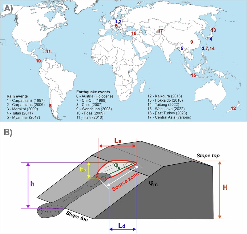
In the landslide research, the team concentrates on multidisciplinary studies of various types of slope processes, ranging from deep-seated landslides through debris flows to rockfalls, with our study sites spread both in the Czech Republic and worldwide (Peru, Svalbard, Kyrgyzstan, Austria, Canary Is., etc.). In our work we apply innovative methods and approaches, including geophysical, geodetical, remote sensing and monitoring techniques, combined with various environmental data to assess the landslide hazard and to propose suitable mitigation measures. We therefore often work as consultants for both state institutions and private enterprises.

2. Tectonics
The research focus of the team is the monitoring of the slow, yet omnipresent aseismic creep along tectonic faults. These movements, with velocity varying from centimetres in highly active areas to less than 0.01 millimetres/year in less active regions, accommodate part of the tectonic stress and thus their understanding is one of the crucial conditions for the development of forecasting of the earthquakes, the ultimate goal of tectonic and seismic research. Our dedicated network for the fault monitoring TecNet covers many countries in Europe and the World. Recently, we have advanced towards calculation of current stress field and its changes, based on our direct measurements on tectonic faults.

3. Monitoring and instruments development
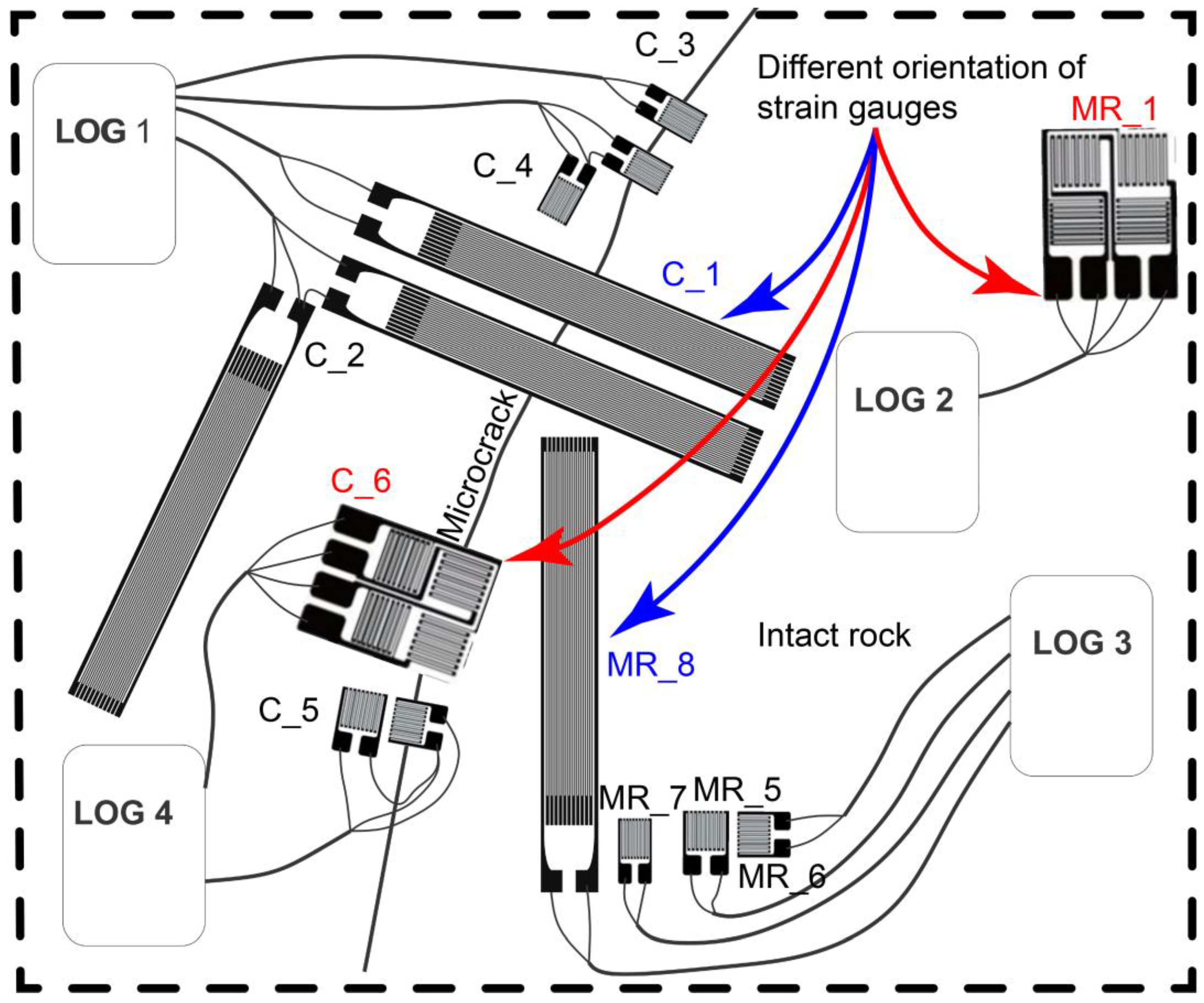
Since 1970ies, the department team is very active in the development and applications of monitoring devices. Our specialty is a very precise 3D dilatometer TM-71, continuously developed form the first optical-mechanical models towards the current device with better precision, automatic reading, data transfer and processing. The improvements are partly aided by in-house design and production of new parts using 3D printing technology. We also test and apply the cutting-edge technologies and methods like TLS (terrestrial laser scanner or LiDAR), modern geophysical methods or UAVs (unmanned aerial vehicles or drones).

Other current research interests and undertakings (Slope tectonics, Rock weathering, Research for practice, Monitoring networks, Databases)

International Cooperation

University of Strathclyde, Scotland,
UK
Scotland,
UK
University of Florence
Italy

Project: The EU TecNet monitoring network provides very precise measurements of tectonic creep, using a series of crack gauges known as TM-71s and GPS measurement.

Localities: Colfiorito, Norcia, Matinatta (Gargano), Central and South Apennine Mountains

National Geographic Society and Waitt Grant
Spain

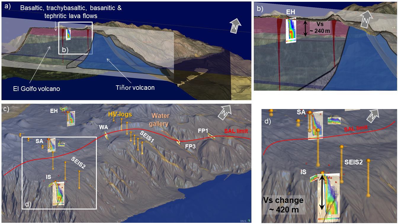
Mega-landslides: imminent hazard or sleeping giants? Monitoring the landslide hazard related to ongoing volcanic activity around El Hierro, Canary Islands, Spain (Grant No.: W244-12, 2012-2013)
Investigators:
Dr. J. Yepes, University of Gran Canaria,
Dr. I. Galindo Jimenez, IGME,
Dr. S. Metliditis, IGN,
Mgr. Jan Blahut, Ph.D. and RNDr. Jan Klimes, Ph.D.

Instituto Geográfico Nacional, Tenerife, Spain
Spain-Canary Islands
Corinth Rift Laboratory - NAS-3F-
CORINTH
Greece

Project: TecNet 3-D monitoring of displacements on faults and GPS measurements earth movement, Photo
Location: Gulf of Corinth

Geological Institute, Slovak Academy of Sciences
Slovakia

"Contact the Western Carpathians and the Bohemian Massif from the perspective of tiny tectonics in cliff zone based on the measurement and interpretation of results from natural underground space and possible correlations in the region" - Inter-Academy cooperation, 2012-2014, Dr. Joseph Vozar, Dr. Milos Briestenský, Ph.D.

University of Bern, Switzerland
Switzerland
Geological Institute of the Bulgarian Academy of Sciences
Bulgaria

Monitoring and forecasting of hazardous geological processes,
2014 - 2016

investigator: J. Stemberk and N. Dobrev

Pavol Jozef Šafárik University, Košice
Slovakia

Doc. Zdenko Hochmuth, UPJŠ, Kosice, Slovakia - Joint geodynamic network Slovak Karst, articles.

National Archaeological Park of
Machup icchu, Peru
Peru
Karst Research Institute, Postojna
Slovenia

Project: TecNet 3-D monitoring of displacements on faults and GPS measurements earth movement

Locations: Vremščica, Postojna Cave

National lnstitute for Geophysics, Geodety and Geography BAS
Bulgaria

academic cooperation - project: Tectonic activity of the significant karst systems (development correlation of the Central Europe and Mediterranean area)

Natural History Museum Vienna
Austria
Seismological Institute in Lima
Peru

Project: The EU TecNet monitoring network provides very precise measurements of tectonic creep, using a series of crack gauges known as TM-71s

Lokality: Pitec - Huaraz, province Ancash,

measurement is provided by Faculty of Science, Charles University in Prague

Slovak Geological Survey – GÚDŠ, Bratislava
Slovakia

Tecnet.cz

Institute of Seismology, National Academy of Sciences of the Kyrgyz Republic, Bishkek
Kyrgyzstan

The EU TecNet monitoring network provides very precise measurements of tectonic creep, using a series of crack gauges known as TM-71s.

Localities: Boom Galerry, Ala-Archa,

Investigator: Josef Stemberk

University of Liège
Belgium
The Peruvian National Institute of Meteorology and Hydrology
Peru

Project: "Hazard assessment of dangerous landslides and glacial lake outburst floods, Cordillera Blanca, Peru (GAP209/11/1000 - 2011-2014)

Principal investigator: RNDr. Jan Klimeš, Ph.D.

Univerzita Mateja Bela, Centrum vedy a výskumu, Banská Bystrica
Slovakia
Geophysical Institute of the Polish Academy of Sciences, the Polish Polar Station, Hornsund, Svalbard
Norway

3D monitoring of displacements on faults and GPS measurements earth movement
Location: bay Hornsund, Polish Polar Station

Johannes Guttenberg University
Germany
Slovenian National Building and Civil Engineering Institute Ljubljana
Slovenia

Joint projects in the years 2011 - 2014

Arba Minch University
Ethiopia

Student mentoring, geohazard monitoring. Development projects financed by the Czech Development Agency.

Karlsruhe Institute of Technology
Germany

The EU TecNet monitoring network provides very precise measurements of tectonic creep, using a series of crack gauges known as TM-71s and GPS measurement.

Localities: Lorettotunnel (Freiburg), Wattkopftunnel (Karlsruhe)

Investigator: josef Stemberk


Wrocław University of Environmental and Life Sciences
Poland
Geologische Bundesanstalt Wien
Austria

Geological map 1:50000, Blatt Haslach,

Project coordinator for the Czech side is Dr.. Krystof Verner, PhD. of Czech Geologicla Survey

Kyoto University
Japan

slope movements

Technische Universität Darmstadt
Germany

The EU TecNet monitoring network provides very precise measurements of tectonic creep, using a series of crack gauges known as TM-71s and GPS.

Localities: Congress Center Darmstadt

Investigator: Josef Stemberk

National Research Institute of Glaciers and Mountain Ecosystems of Peru (INAIGEM)
Peru
Brigham Young University
USA

Project: "Multi-disciplinary study of the processes in the sandstone outcrops: a new approach to research and interpretation of selected sandstone forms" (GA13-28040S, 2013-2015), Investigator: Mgr. Jana Schweigstillova, Ph.D.,
cooperation Dr. A. Mayo

The Central Geological Survey (CGS), under the Ministry of Economic Affairs (MOEA)
Tchaj-wan

slope and fault movements

NAGRA (National Cooperative for the Disposal of Radioactive Waste)
Switzerland

Project: TecNet 3-D monitoring of displacements on faults and GPS measurements earth movement - Grimsel underground laboratory,

Investigator: J. Stemberk

Comenius University in Bratislava
Slovakia
Autoridad Nacional del Agua
Peru

GAP209/11/1000 - "Hazard assessment of dangerous landslides and glacial lake outburst floods, Cordillera Blanca, Peru" (2011-2014) - RNDr. Jan Klimes, Ph.D.,Ing. Alejo Cochacin

The Council for Geoscience (CGS) of South Africa
South African Republic

slope and fault movements

Univerzita Camerino
Italy

Project: The EU TecNet monitoring network provides very precise measurements of tectonic creep, using a series of crack gauges known as TM-71s and GPS measurement.

Localities: Colfiorito, Norcia, Matinatta (Gargano)

Instituto Geofisico del Peru, Lima
Peru

International cooperation without grant (Articles) 2013:
Dr. Edmundo Norabuena - Common geodynamic laboratory and create articles.
Dr. Mauro Rossi, CNR-IRPI, Perugia, Italy - article on the stability of slopes in the vicinity of Machu Picchu.

Results

Rate-dependency of residual shear strength of soils: implications for landslide evolution

2023

Duque, J., Loche, M., & Scaringi, G. (2023). Rate-dependency of residual shear strength of soils: implications for landslide evolution. Géotechnique Letters, 13(2),1-8. https://doi.org/10.1680/jgele.23.00004

New Insights into the Internal Structures and Geotechnical Rock Properties of the Giant San Andrés Landslide, El Hierro Island, Spain

2023

Klimeš, J.; Hussain, Y.; Mreyen, A.-S.; Cauchie, L.; Schlögel, R.; Piroton, V.; Petružálek, M.; Blahůt, J.; René, M.; Meletlidis, S.; Havenith, H.-B. (2023) New Insights into the Internal Structures and Geotechnical Rock Properties of the Giant San Andrés Landslide, El Hierro Island, Spain. Remote Sens., 15, 1627. https://doi.org/10.3390/rs15061627


Deformation of columnar calcite within flowstone speleothem

2023

Mitrovic-Woodell, I., Tesei, T., Plan, L., Habler, G., Baroň, I., Grasemann, B. (2023): Deformation of columnar calcite within flowstone speleothem. - Journal of Structural Geology 174 (2023), 16 pp.104924. 
https://doi.org/10.1016/j.jsg.2023.104924

Long-term landslide impacts and adaptive responses in rural communities: Using historical cases to validate the cumulative causation approach

2023

Raška, P., Riezner, J., Bíl, M., Klimeš J. (2023) Long-term landslide impacts and adaptive responses in rural communities: Using historical cases to validate the cumulative causation approach. International Journal of Disaster Risk Reduction, 93, https://doi.org/10.1016/j.ijdrr.2023.103748

Portable muon detectors tested at the British Cave Science Centre

2023

Rowberry, M., Trčka, T., Mikluš, V., 2023. Portable muon detectors tested at the British Cave Science Centre. Cave and Karst Science, v. 50 (3), pp113-118.

Anatomical growth response of Fagus sylvatica L. to landslide movements

2023

Šilhán, K., Balek, J., Hartvich, F., Klimeš, J., Blahůt, J., Hampel, F., 2023. Anatomical growth response of Fagus sylvatica L. to landslide movements. Science of the Total Environment 867, 161554. 
http://dx.doi.org/10.1016/j.scitotenv.2023.161554

Application of novel ensemble models to improve landslide susceptibility mapping reliability

2023

Tong, Z. L., Guan, Q. T., Arabameri, A., Loche, M., & Scaringi, G. (2023). Application of novel ensemble models to improve landslide susceptibility mapping reliability. Bulletin of Engineering Geology and the Environment, 82(8), 309.  https://doi.org/10.1007/s10064-023-03328-8

Investigating the Potential of Infrared Thermography to Inform on Physical and Mechanical Properties of Soils for Geotechnical Engineering

2022

Loche M, Scaringi G, Blahůt J, Hartvich F (2022) Investigating the Potential of Infrared Thermography to Inform on Physical and Mechanical Properties of Soils for Geotechnical Engineering. Remote Sensing. 14(16):4067. DOI: 10.3390/rs14164067

Monospecific mass associations of Anaconularia anomala (Cnidaria, Scyphozoa) from the Upper Ordovician of the Czech Republic: sedimentological and palaeobiological significance

2022

Bruthansová J, Bruthans J, Van Iten H, Rak Š, Schweigstillová J (2022) Monospecific mass associations of Anaconularia anomala (Cnidaria, Scyphozoa) from the Upper Ordovician of the Czech Republic: sedimentological and palaeobiological significance. Lethaia 55(2):1–18. DOI: 10.18261/let.55.2.7

Evaporation rate from surfaces of various granular rocks: Comparison of measured and calculated values

2022

Slavík M, Bruthans J, Schweigstillová J (2023) Evaporation rate from surfaces of various granular rocks: Comparison of measured and calculated values. Science of the Total Environment, 856(2):159114. DOI: 10.1016/j.scitotenv.2022.15911

Three large prehistoric earthquakes in the Eastern Alps evidenced by cave rupture and speleothem damage

2022

Baroň I, Plan L, Grasemann B, Melichar R, Mitrović-Woodell I, Rowberry M , Scholz D: Three large prehistoric earthquakes in the Eastern Alps evidenced by cave rupture and speleothem damage. Geomorphology 408. DOI: 10.1016/j.geomorph.2022.108242

Co-seismic deformation of the 2017 Mw 6.6 Bodrum–Kos earthquake in speleothems of Korakia Cave (Pserimos, Dodecanese, Greece)

2022

Grasemann B, Plan L, Baroň I , Scholz D (2022): Co-seismic deformation of the 2017 Mw 6.6 Bodrum–Kos earthquake in speleothems of Korakia Cave (Pserimos, Dodecanese, Greece). Geomorphology 402: DOI: 10.1016/j.geomorph.2022.108137

Three-Dimensional Engineering Geological Model and Its Applications for a Landslide Site: Combination of Grid- and Vector-Based Methods

2022

Nguyễn T-T, Dong JJ, Tseng C-H, Baroň I , Chen C-V, Pai C-C (2022): Three-Dimensional Engineering Geological Model and Its Applications for a Landslide Site: Combination of Grid- and Vector-Based Methods. Water 2022, 14(19): 2941. 10.3390/w14192941

Post-Miocene tectonics of the Northern Calcareous Alps

2022

Szczygieł J, Baroň I, Melichar R, Plan L, Mitrović-Woodell I, Kaminsky E, Scholz D, Grasemann B (in print): Post-Miocene tectonics of the Northern Calcareous Alps. Scientific Reports volume 12, Article number: 17730 (2022) Cite this article

Differentiating between artificial and natural sources of electromagnetic radiation at a seismogenic fault

2022

Baroň I , Koktavý P, Trčka T, Rowberry M, Stemberk J, Balek J, Plan L, Melichar R, Diendorfer G, Macků R, Škarvada P, (2022) :  Differentiating between artificial and natural sources of electromagnetic radiation at a seismogenic fault. Engineering Geology 311(1–7):106912, DOI:10.1016/j.enggeo.2022.106912
 

Tools for the efficient analysis of surface waves from active and passive seismic data: exploring an NE-Italy perilagoon area with significant lateral variations

2022

Dal Moro G, Stemberk J (2022) Tools for the efficient analysis of surface waves from active and passive seismic data: exploring an NE-Italy perilagoon area with significant lateral variations. Earth, Planets and Space volume 74, Article number: 140 (2022) Cite this article. DOI: 10.1186/s40623-022-01698-z

Application of fractal and multifractal analysis on Blue Nile drainage patterns in the morphostructural analysis of the Ethiopian highlands, Ethiopia

2022

Kusák M (2022) Application of fractal and multifractal analysis on Blue Nile drainage patterns in the morphostructural analysis of the Ethiopian highlands, Ethiopia. Progress in Physical Geography: Earth and Environment, Volume 46, Issue 3, 357–370. DOI: 10.1177/03091333211059419

Exploring the impact of tourists on cave air temperatures: a Covid-19 case study from Poole’s Cavern, Derbyshire, UK

2021

Article
Gunn J, Rowberry M , Smith A (2021) Exploring the impact of tourists on cave air temperatures: a Covid-19 case study from Poole’s Cavern, Derbyshire, UK. Cave & Karst Science 48: 121-128. www.researchgate.net/publication

Atmospheric pressure anomalies at the British Cave Science Centre triggered by catastrophic volcanic eruption in Tonga on 15 January 2022

2022

Rowberry M , Gunn J (2022) Atmospheric pressure anomalies at the British Cave Science Centre triggered by catastrophic volcanic eruption in Tonga on 15 January 2022. Cave & Karst Science 49: 14-18. www.researchgate.net/publication

Home Advances in Natural Hazards and Volcanic Risks: Shaping a Sustainable Future Conference paper A Decade of Monitoring and Research on the San Andrés Megalandslide on El Hierro, Canary Islands, Spain

2022

Part of the Advances in Science, Technology & Innovation book series (ASTI)
Blahůt J, Klimeš J, Meletlidis S, Balek J, Rowberry M, Baroň I A decade of monitoring and research on the San Andrés megalandslide on El Hierro, Canary Islands, Spain. Advances in Natural Hazards and Volcanic Risks: Shaping a Sustainable Future - Proceedings of the 3rd International Workshop on Natural Hazards (NATHAZ22), Terceira Island - Azores 2022, Springer ASTI Series. First Online: 21 April 2023

Rock Mass Characterization and Rockfall Monitoring: Traditional Approaches

2022

Kapitola v odborné knize
Racek O, Blahůt J Rock Mass Characterization and Rockfall Monitoring: Traditional Approaches. In Thambidurai P, Singh TN (eds) Landslides: Detection, Monitoring and Prediction – Technological Developments. Springer, 2023, DOI: 10.1007/978-3-031-23859-8_2

A global database of giant landslides on volcanic islands

2022

Kapitola v odborné knize

Rowberry M, Klimeš J, Blahůt J, Balek J, Kusák M (2022) A global database of giant landslides on volcanic islands. Progress in Landslide Research and Technology, Volume 1, Issue 1. Springer, 9783031169007. 10.1007/978-3-031-16898-7_22 

Services

GPS/GNSS měření

GPS/GNSS měření
Přesné měření polohy pomocí GPS/GNSS s post-processingem Aschtec Z-MAX Jan Blahůt
(Oddělení inženýrské geologie)
Přesné určení polohy formou kampaňového měření (24/48 h) Topcon HIPER+

Laserové skenování

Vrtné práce

SEM analýzy a EDS prvková analýza materiálů

Klimatická komora

Geotechnický / Geologický monitoring pohybů